The people in Boylston and West Boylston were not happy. In their view the Metropolitan Water Board had come to take a lot from them without offering much in return. The Water Board had its mandate, however, and was determined to perform its duties as directed.
Boylston had lost a significant portion of its rich farmland while West Boylston had sacrificed its entire industrial base and a goodly portion of its housing.
After years of dickering things had come down to a single issue – the final location of a direct route connecting the two town centers.
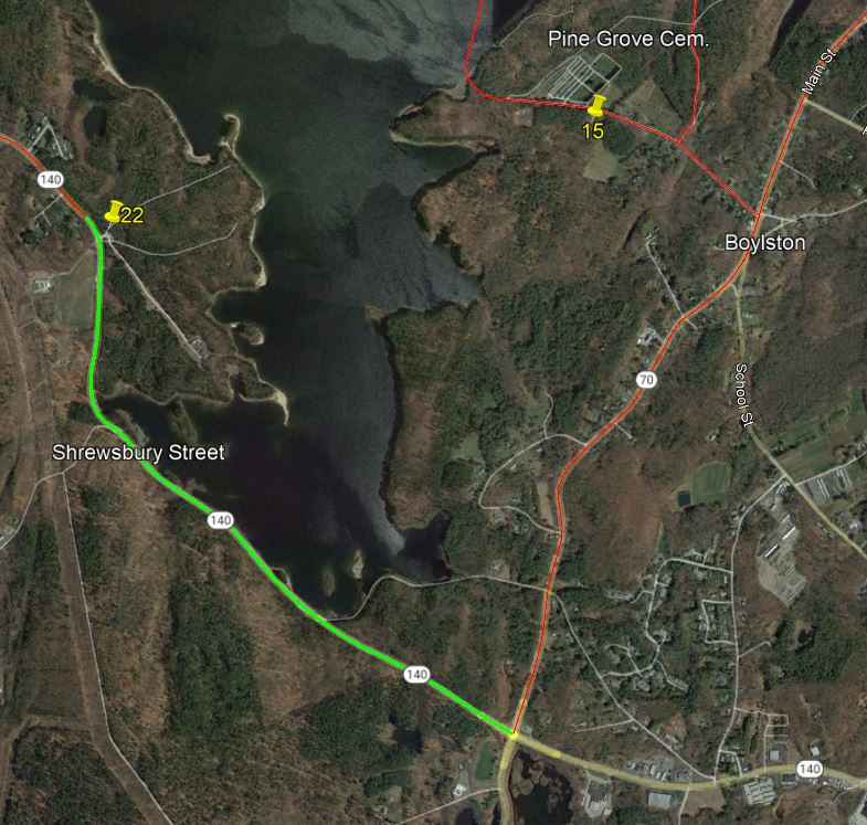
The Board wanted a longer route around the new reservoir and the towns wanted a shorter route across it.
I recently gained access to a vast collection of newspaper articles written by local contemporary reporter, Mary A. Cook, and preserved by the folks at the Beaman Library and decided to tell this story from the perspective of the inhabitants.
Read on to find out how this often bitter discussion was finally settled.
I hope you like it.
Thanks,
Paul
.
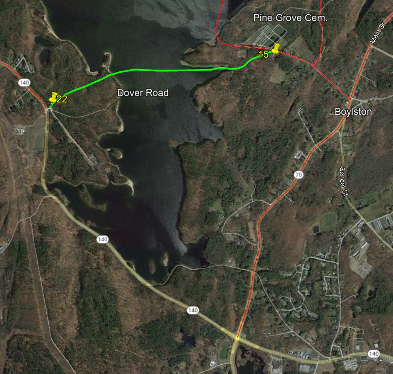
Note: The Dover Road once ran in practically a straight line from Gate 15 opposite the Pine Grove Cemetery on Scar Hill Road in Boylston, across and under the Wachusett Reservoir, to Gate 22 at the entrance to the Mass. Division of Fisheries & Wildlife on Shrewsbury Street (Rte. 140) in West Boylston.
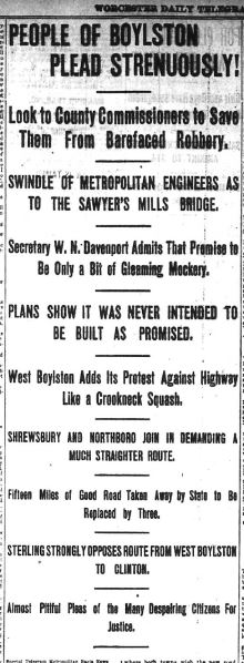
Report of the Hearing with the County Commissioners
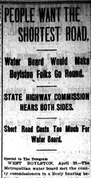
Report of the Appeal to the State Highway Commission